
Assessment of Changes in the Lower Keys Tarpon Fishery
In 2022, the Lower Keys Guides Association approached BTT with concerns about the declining Tarpon fishery. To strategize a plan of action, I conducted semi-structured interviews and had guides draw their fishing spots throughout their time in the fishery - a process that requires an immense amount of trust. Through the application of GIS, Python, and R, I identified spatiotemporal trends in decline and abiotic/biotic correlates of the decline using gradient boosted regression models. Together we strategized proposals to the Florida Keys National Marine Sanctuary for better waterway navigational markers to address the drastic increase in recreational boater traffic that disrupts Tarpon migrations and destroys flats/seagrass habitats.
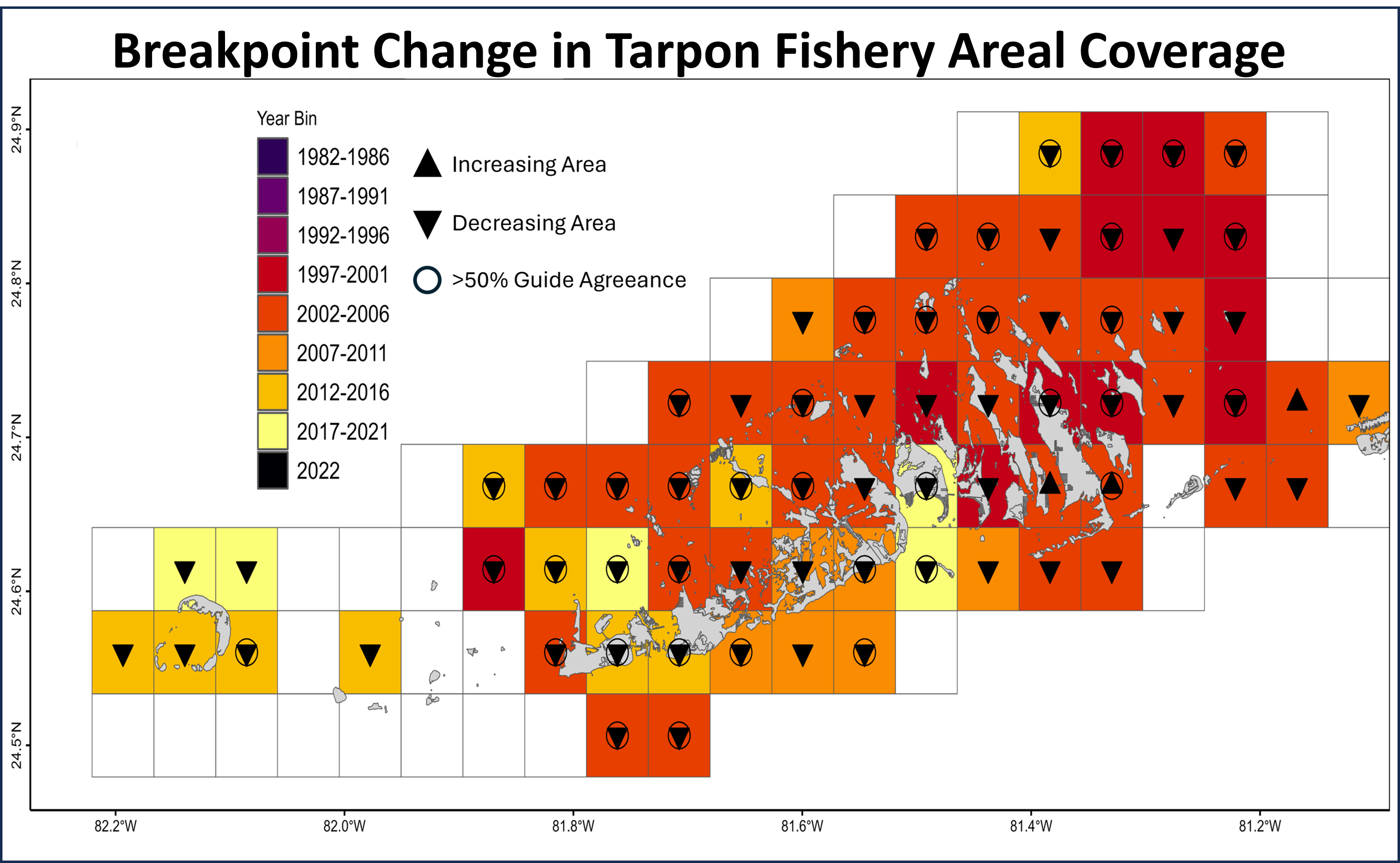 The analysis of the guide-drawn fishing maps resulted in identifying when and where declines began to occur in the Lower Keys Tarpon fishery.
High-density vessel traffic areas (pink, dark orange) spatially align with areas where only 0-20% of the historical Tarpon fishery remain.
 Recreational boat traffic in the Florida Keys causes significant damage to seagrass flats and disruption of access to channels that are used by Tarpon.